Road Trip Around Western Colorado
Our first road trip took us west from Denver along I-70, climbing steadily until we reached the Eisenhower Tunnel.
I have to confess I had had not heard of this tunnel before, but it was when it was constructed (in 1973) it was
the highest road tunnel in the world, with a maximum elevation of 3401m above sea level.
And as if to emphasise how high we had climbed, we emerged from the tunnel into falling snow – in May!
Not heavy snow, but snow nevertheless.
We carried on along I-70, with the Colorado River – the river that further downstream flows through the
Grand Canyon – on our left for much of the way.
And then, at Glenwood Springs, we headed south towards our first destination.
The Black Canyon of the Gunnison
If you have never heard of the Black Canyon of the Gunnison,
you’re in good company.
I hadn’t heard of it before the planning for this trip, and no-one I have spoken to about it since has said
that they had heard of it either.
But it is truly spectacular – a very narrow gorge, extremely deep, with near-vertical sides.
It is named the Black Canyon because for much of the year, sunlight rarely if ever reaches the bottom.
And the Gunnison River which flows through the canyon eventually joins up with the Colorado – the water
that you see in the photo will also have to go through the Grand Canyon before it reaches the ocean.
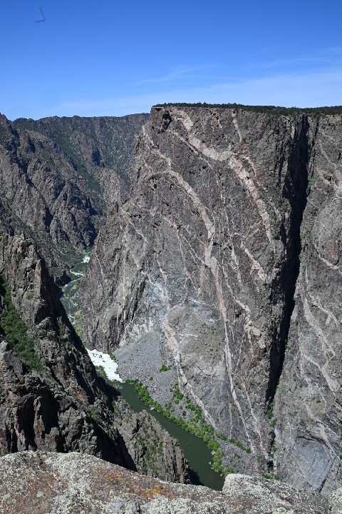
This is the “Painted Wall” – the lighter bands are known as “dikes”, formed when
molten rock flowed into gaps in the existing rock.
To understand the scale of the above photograph – the height of this rock face from the river (the white
water barely visible at the bottom of the wall) to the rim is 685 metres.
That’s more than twice the height of the Eiffel Tower (324m), and considerably higher than the rebuilt One
World Trade Center tower (417m excluding the spire).
As you might expect, there is no way of getting from one side of the canyon to the other, except for a very long
drive.
We saw the canyon first from the less accessible north side; the photo above was taken the following day when we
went back to the south side (the side with the information centre).
Just before we left the Black Canyon area, we took a detour to a tiny place called Cimarron, where we found this:
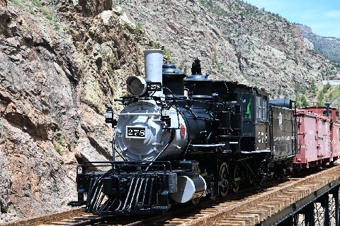
The Denver & Rio Grande Western Railroad had at one time had a line through the upper, less inhospitable part
of the Black Canyon.
When that part of the canyon was flooded by the Morrow Point Dam, a small section of bridge was preserved with a
locomotive and a couple of wagons on it.
Mesa Verde
The next day we hit the road again, heading south to Mesa Verde.
The Mesa Verde National Park covers a large area of south-western Colorado, and it is notable for several
remarkable groups of dwellings constructed into the cliff faces by the Native American peoples of the area in
about the 13th century CE.
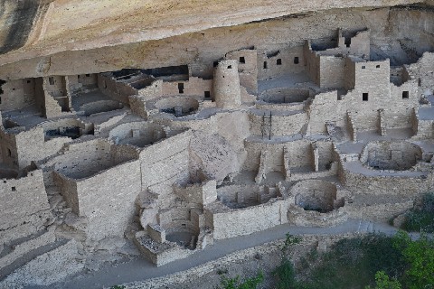
We had booked a guided tour, which took us down into the Cliff Palace, the largest of the settlements.
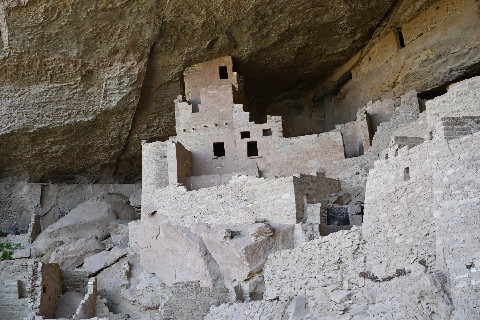
In a country – the United States – that has existed for only a few hundred years, it was an odd
experience to walk around among buildings that had been built several centuries before Columbus.
Shiprock
Heading even further south, just across the border into the state of New Mexico is Shiprock – an enormous
example of the volcanic plug geological formation.
Rising over 480 metres out of a broad plain, it must have appeared to the first europeans who saw it as being
something like the clipper ships of the era, although to our eyes it is perhaps more reminiscent of a mediaeval
castle.
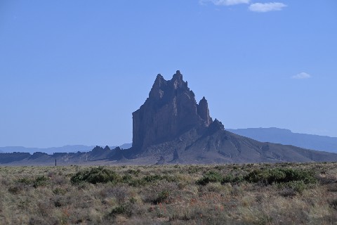
Unfortunately, the car we were travelling in didn’t have the ground clearance to allow us to get any closer
to the rock itself, and the late afternoon sun left much of the rock in shadow, but it was a striking vision
nevertheless.
Durango & Silverton Narrow Gauge Railroad
Anyone who knows me well knows that I have a long-standing interest in trains.
I know that this is not an interest that is widely shared among my friends in America, so I was a little hesitant
about suggesting spending very much time on this topic, but I was delighted that my friend was prepared to humour
me, and to visit not one but two heritage lines in the area.
The Denver & Rio Grande Western Railroad had an extensive network of narrow-gauge (3 foot) lines in Colorado
and New Mexico, but by about the middle of the 20th century, these were becoming uneconomic.
Some lines were closed, some were converted to standard gauge and two lines were sold to heritage operators as
tourist railroads.
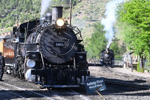
The Durango & Silverton Narrow Gauge Railroad is
perhaps the best-known of these heritage lines.
It runs between (unsurprisingly) Durango and Silverton in western Colorado, a distance of about 72 kilometres.
The above photo shows our train about to leave Durango (the locomotive on the right was moving around to connect
on to the front of the other locomotive to double-head the train for part of the journey).
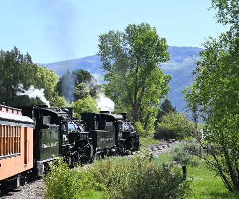
Like with many such lines, the journey starts out quietly enough, travelling through the rural countryside around
Durango.
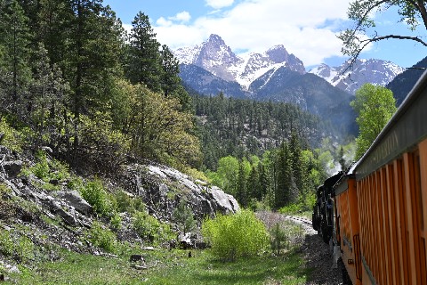
But then it starts to climb as it follows the Animas River, at one point navigating a ledge carved into the rock
high above the river below.
It is here that the leading locomotive detaches and runs on ahead to reduce the load on the track at a
particularly precarious point.
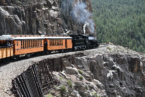
And just a reminder that we’re in the Rockies – we’ve climbed a considerable amount by this
stage but the mountains are still towering way above us.
Cumbres & Toltec Scenic Railroad
In contrast, the Cumbres & Toltec Scenic Railroad starts on the plains of the San Luis Valley in southern Colorado, climbs steadily to the Cumbres Pass at 3053
metres elevation, then descends into Chama, New Mexico – a distance of 103 km.
Along the way, it loops back on itself several times to gain or lose height, crossing the Colorado - New Mexico
border 11 times.
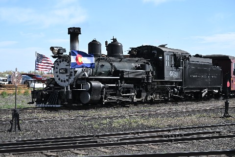
We caught the first train on the first day of the season.
It was Memorial Day, and the locomotive was decked out in US and Colorado flags.
At the half-way point, we met a train heading in the opposite direction, and swapped locomotives.
The western half of the line has steeper grades, and requires a more powerful engine.
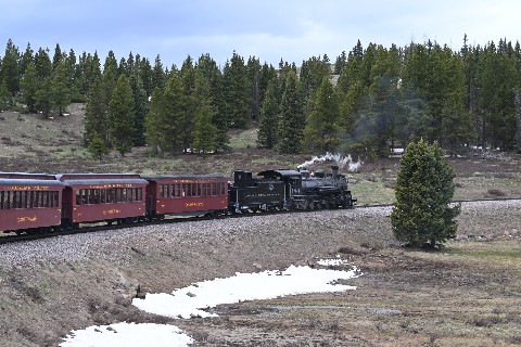
(Yes, that’s snow on the ground – remember, we’re at an elevation of over 3000 metres.)
And the looping nature of the line is very obvious at many points – the track on the right in the photo
below is the track that the train just used a moment before.
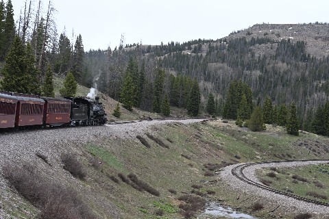
And of course one benefit (for the photographer) of the looping line is that there are frequent opportunities to
get a photo of the locomotive pulling the train that you’re on.
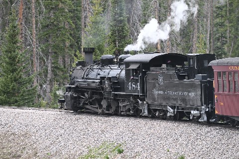
Overall, it’s hard to choose a favourite between the two lines.
The Durango & Silverton seems a little more professional, but the Cumbres & Toltec has a more informal
charm.
On the Durango & Silverton you’re looking up at the high peaks of the Rockies; on the Cumbres &
Toltec you’re often looking down to the valley below.
I greatly enjoyed both lines, and I strongly recommend both to any potential visitors.
Great Sand Dunes
This was perhaps our only failure of the trip. The Great Sand Dunes National Park is on the eastern side of
the San Luis Valley, and it includes a large area of sand dunes of up to 230 metres in height.
We had planned to go there the day after our visit to the Cumbres & Toltec Scenic Railroad, but this was
Memorial Day weekend, and a large number of other people had had the same idea.
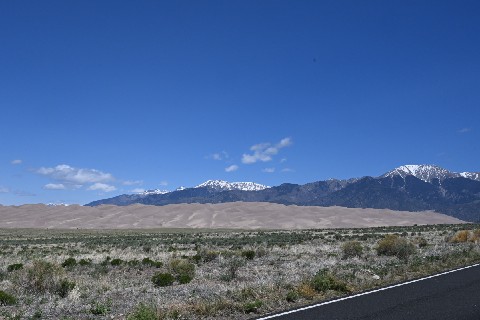
After waiting for a while in a very slow-moving line of cars on the only road into the area, we decided to give
up.
This was as close as we got.
Royal Gorge
Royal Gorge is another steep-sided canyon, but this time
on the Arkansas River.
Remember, the Continental Divide runs north-south through Colorado; water flowing down the Gunnison River joins
the Colorado River and eventually reaches the Pacific Ocean, while just a few kilometres away, water flowing down
the Arkansas joins the Mississippi, and reaches the sea in the Gulf of Mexico.
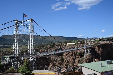
Royal Gorge is a major tourist destination, with a pedestrian suspension bridge across the gorge, a zipline and a via ferrata.
There is a rail line (standard gauge) through the gorge, and the suspension bridge offers a great position for
photographs.
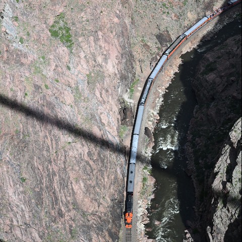
A tourist train (diesel hauled) runs from Cañon
City through the gorge, and no, we didn’t go on this one.
Maybe next time.
The black line across the photo is the shadow of the support cable for the suspension bridge (I think).
Colorado Railroad Museum
And just for a final dose of train photography, on the way back into Denver we stopped in at the Colorado Railroad Museum at Golden, CO.
Obviously, there were a great many things to photograph there; I’ve chosen a few shots to represent the
variety on display.
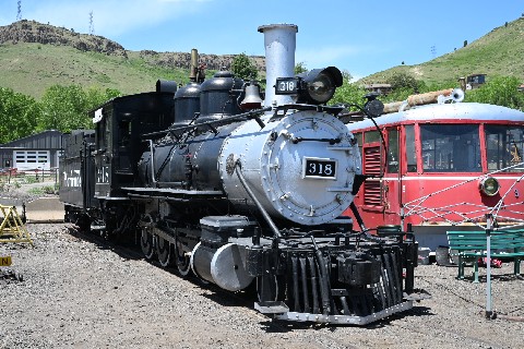
A narrow gauge locomotive of the Denver & Rio Grande Western Railroad at the Colorado Railroad Museum,
alongside a railcar from the Manitou & Pikes Peak Railway.
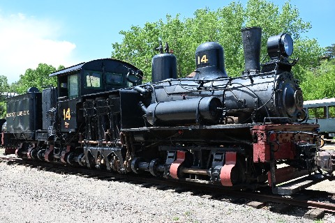
They also had a couple of examples of Shay locomotives – unusual geared steam locomotives often associated
with logging lines.
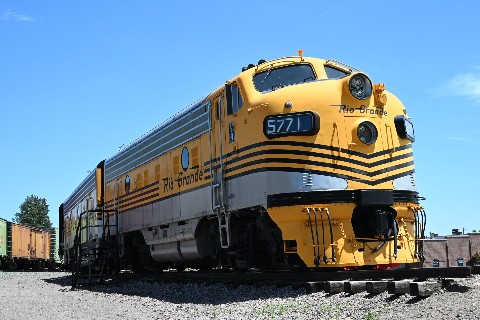
And the museum doesn’t limit itself to steam.
These are EMD F-Units – among the most recognisable American diesel locomotives of the 1950s and 60s
– in the colours of the Denver & Rio Grande Western Railroad.
Back to Denver
And so the first week of my American vacation came to a close.
There’s a whole lot I haven’t managed to fit into this report of the trip, like standing on the Four
Corners where the states of Colorado, New Mexico, Arizona and Utah meet.
Or the visit to the Red Rocks natural amphitheatre just outside Denver.
Or seeing bison, deer, antelope and even a bear (at a distance).
And eating a lot of very good Mexican food (especially at Mi Mexico in Montrose, Colorado).
But something I find hard to communicate is the scale of everything we saw.
America is vast, but within that vastness there is also enormous complexity and variety and individuality.
And this was just one half of one state (plus a little bit of another).